I first started a proper hike back in Malaysia. A bunch of us decided we should give it a go. We hiked Bukit Tabur. Little did I know how hard or dangerous it was going to be. I just went along with my “trustworthy” friends. Haha. It is a hill located in Taman Melawati. It is just on the east of Batu Caves about 11.5 km away. (According to Google Maps)
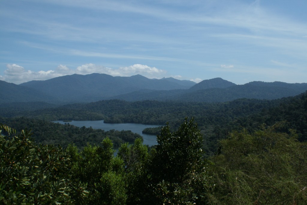
It is known for their crystal quartz outcrop and unique vegetation. It consists of checkpoints, and a few lookout points (although not specifically labelled or indicated). However, it is quite obvious to spot the lookout point. Once there, it overlooks the Klang gates reservoir.
Time: 2.5 – 3 hours
Grade: Hard
Maximum height: <500m
Where: Taman Melawati, Malaysia
It is very dangerous as there is no designated and proper laid out pathway but kinda makes it quite the adventure in a way. You just need to follow the coloured paper trial that can be seen along the ground and sometimes on the trees. Also, there are rocks marked with numbers, which acts like a pit stop. There should be a total of 11 rock signage! So if you’re up to number 5, you can estimate how much more it will take to reach the top! The hikes involves many rocks to climb, a lot of gripping and manuveuring. The rocks can be very steep, almost to a 90 degree angle.
Before you go, please make sure you have proper hiking shoes, that can grip on properly. And you may want to consider wearing some proper gloves, as your hands might hurt from gripping those rocks. (I know mine hurt)
Getting there: The starting point can be hard to find, without any proper signage. Pretty much just look out for Puncak Niaga facility. The starting trail can be found just behind the wall

The climb can be extremely steep. Please make sure you have friends who are quite experience with you! There have been cases of people falling and slipping off the edge. It is really dangerous, so I really warn you to be careful!!!
At the peak or at some peaks, stop to take a look over the Klang Gates river, and once high up enough, you’d get to see the the ridge also known as the “dinosaur” backbone.

It was a very enjoyable hike albeit extremely dangerous, the fact that there was no signage, no proper route, steep rock climbing, deep valleys and jumping from one rock to another looking down to quite a fall.
So if you’re really planning, I suggest you wear proper gear (I’m not kidding about this) and go with experienced hikers and friends who can support you.
Also remember to:
- keep yourself hydrated, especially with the sun out for 24/7 in Malaysia
- bring along energy bars/snacks
- keep a first aid kit with you
- definitely bring a fully charge mobile phone with you – there is reception up there just in case you get lost
- register your name at the Melawati police station – it will help speed up rescue operations if needed
How to get to Bukit Tabur:
– Exit MRR2 at Taman Melawati
– next round-about 9 o’clock
– next round-about 12 o’oclock
– at T-junction turn right and follow the road along the hill until you get to the Puncak Niaga facilities


