May your best miles be those covered by foot – unknown
It has been a while since I did my last hike.
Rinjani has been on my mind for a while. We finally made it happen.
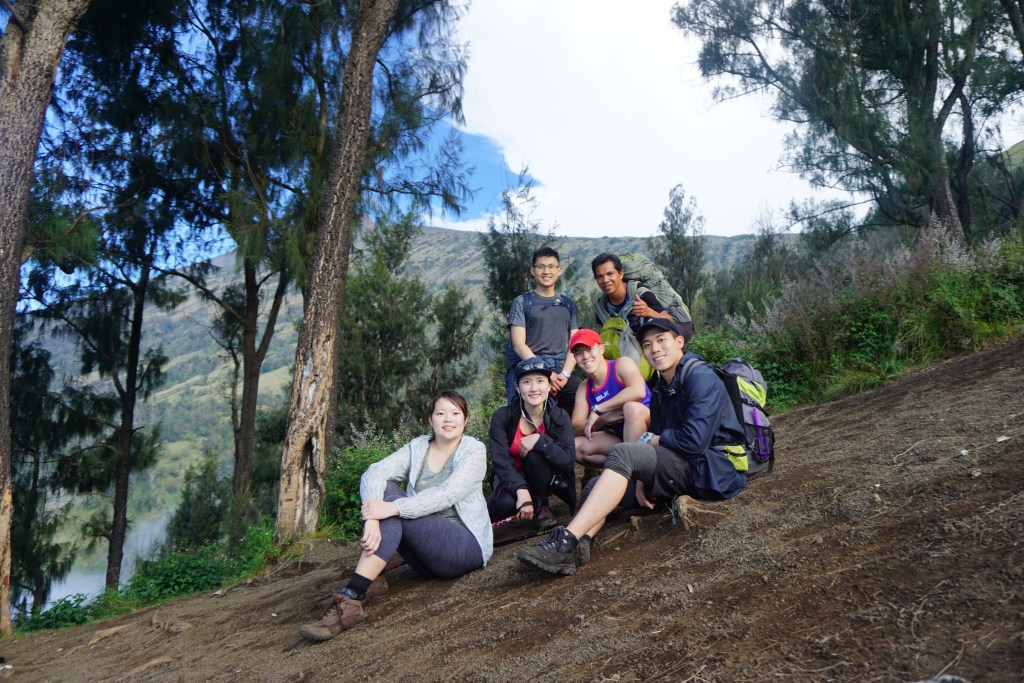
So then there were five of us, going on one epic journey.
There were 6 months of meticulous planning to organize this trip, through a bunch of emails and WhatsApp messages. I’m glad we managed it! Our tour agent, from Galang Ijo was active with emails, made it smooth and possible. After careful research and review, we decided to take on the 4D3N hike package, starting from: Sembalun Village – Sembalun Crater – SUMMIT – Senaru Crater – Senaru Village.
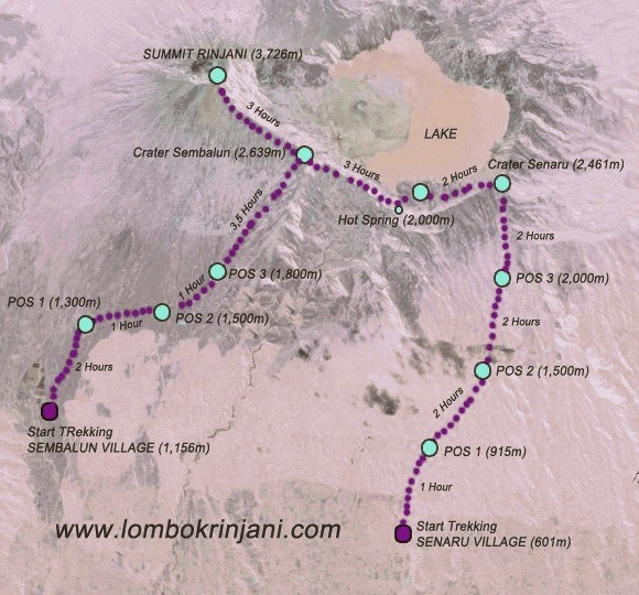
Depending on how many days you’re planning to travel, you will be starting either at Sembalun or Senaru. Since I’m no “Chuck Norris” of hikes so it was best to be prepared for everything!
At the airport, there were plenty of sim cards you can purchase and we were surprised to discover that we could receive 3G network at the peak of Rinjani. A great tourism promo for a quick selfie or insta post. Some brief information to take note if you’re thinking of planning a Rinjani hike:
Peak: 3,726 m above sea level
Time: 1 to 6 days (depending which package you take)
Grade: Hard to extreme hard
The Hike
Day One – The hike up to Sembalun Crater
The day before we started, we slept at Rudi’s Villa which was part of our packaged tour, from Galang Ijo. We were comforted with mattresses and hot water for showers. We made sure to take everything in, knowing that we were going to be on our feet, inside sleeping bags with no back support and no shower, for the next four days.
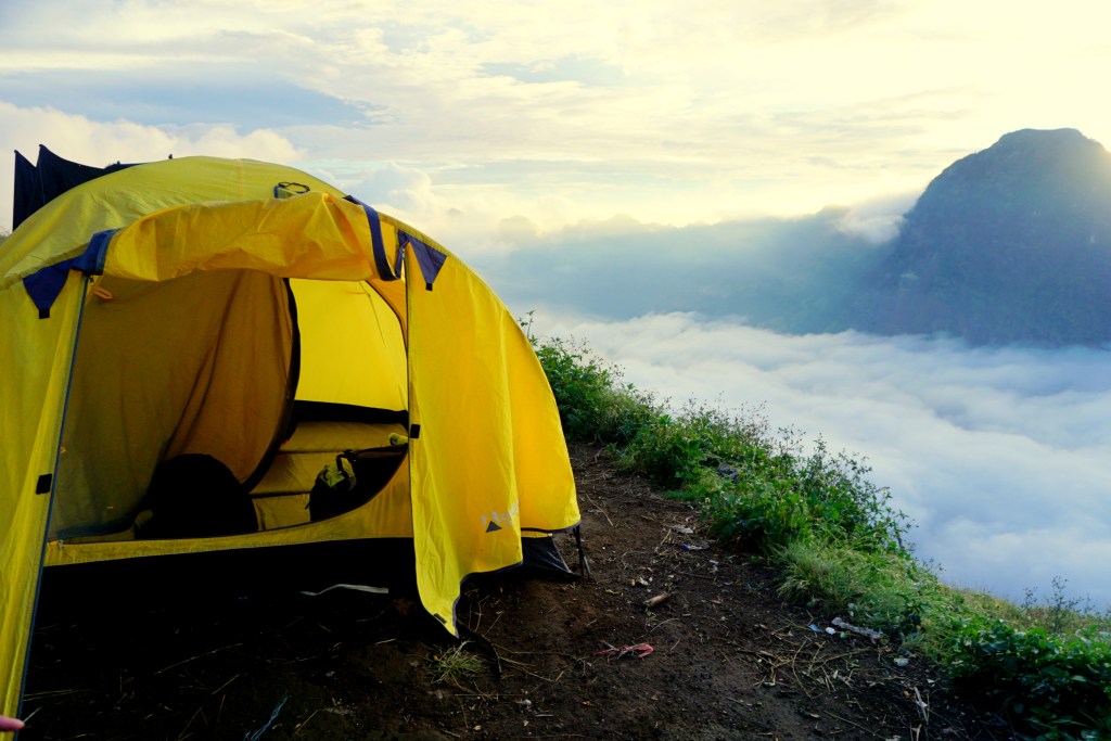
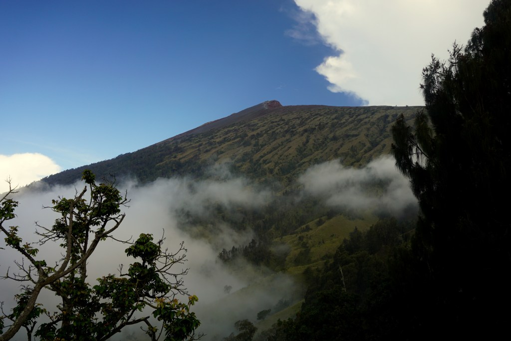
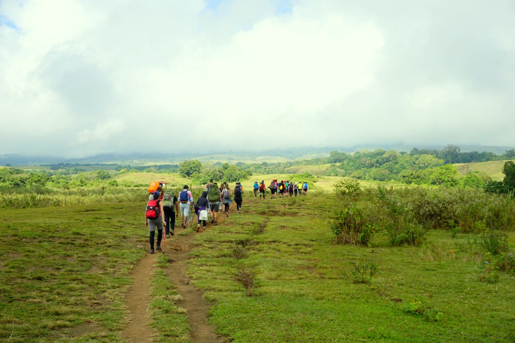
The first day’s hike ends at the Sembalun Crater, where we will be setting camp. The goal is to reach before the sun sets, so that we could take all the view in whilst having our dinner. The hike started on a fairly flat terrain, which ascends quite sharply as we would later discover. For this trip, I was lucky I decided to bring with me a walking pole, which proved to be a life savior! This is now my essential for any of my future hikes.
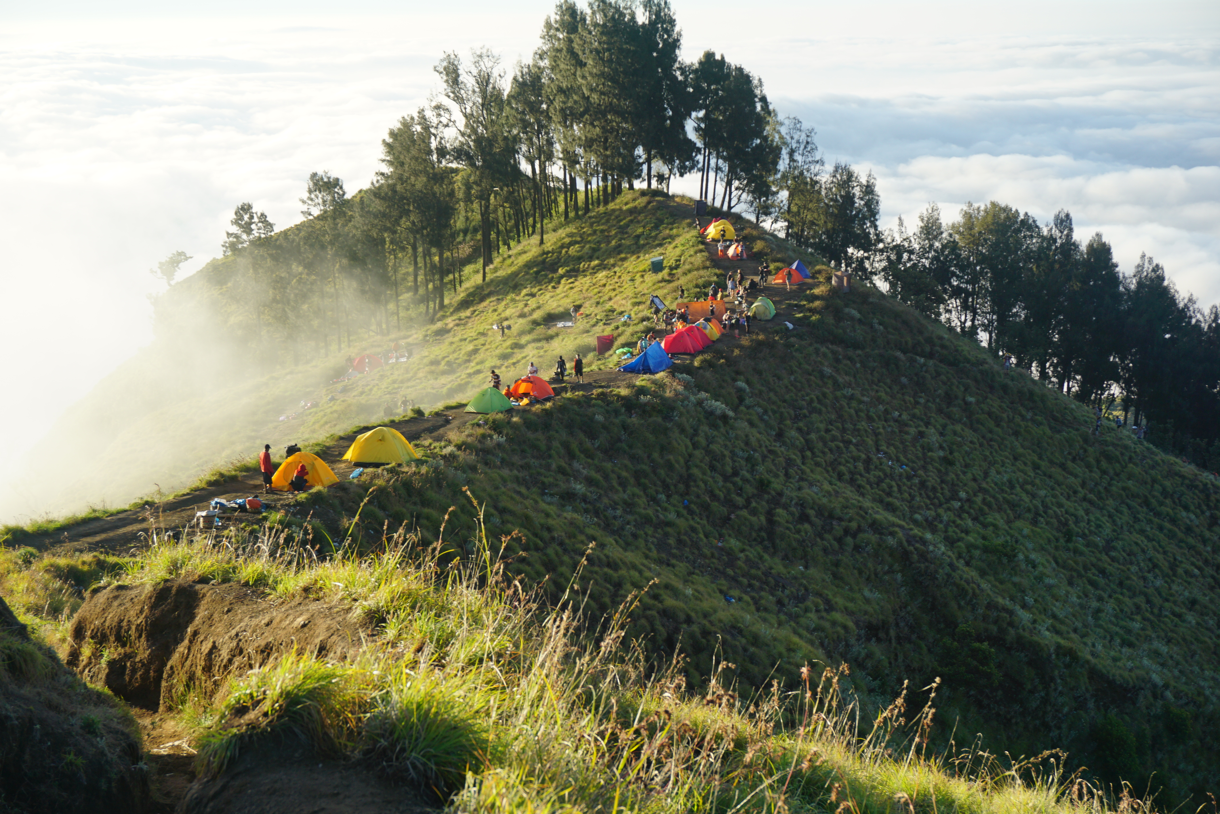
7 grueling hours later, we reached the Sembalun Crater’s campsite and it was absolutely stunning! Our tents were already done by the porters we hired, facing the crater. As we were 2,639 m above sea level, we were LITERALLY above the clouds. The view was breathtaking, as we grabbed photo opportunities, we were fed with fried bananas (pisang goreng) and some heavy carbs to prepare the next morning’s challenging summit hike.
Day Two – The hike to Rinjani Summit
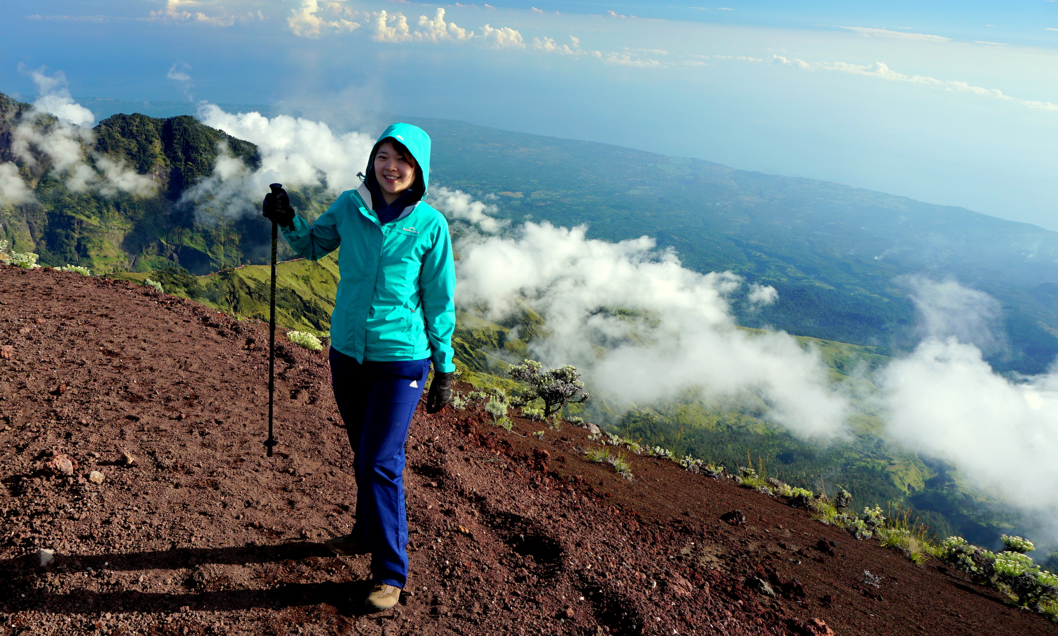
We slept early, mainly because we were drained from the first hike and also, we had to start our summit hike at 2 am in the morning. I must say, it wasn’t the best sleep and it only felt like an hour before we were nudged out of our tents. In the darkness, we carried our torches and started the journey up. In the cold and in the dark, my mind was only focused on one thing : reaching the summit.
Although the only source of light guiding our trail was our head-torch, there were many other hikers going up the very same time. Following only one path, looking ahead and back, we could see the torches lit the path like a concert filled with waving flashlights. As we got higher, every step became a struggle; the trees were getting lesser, the air thinner, the ground turned into rocky/gravel paths and the skies became clearer as the sun begun to rise.
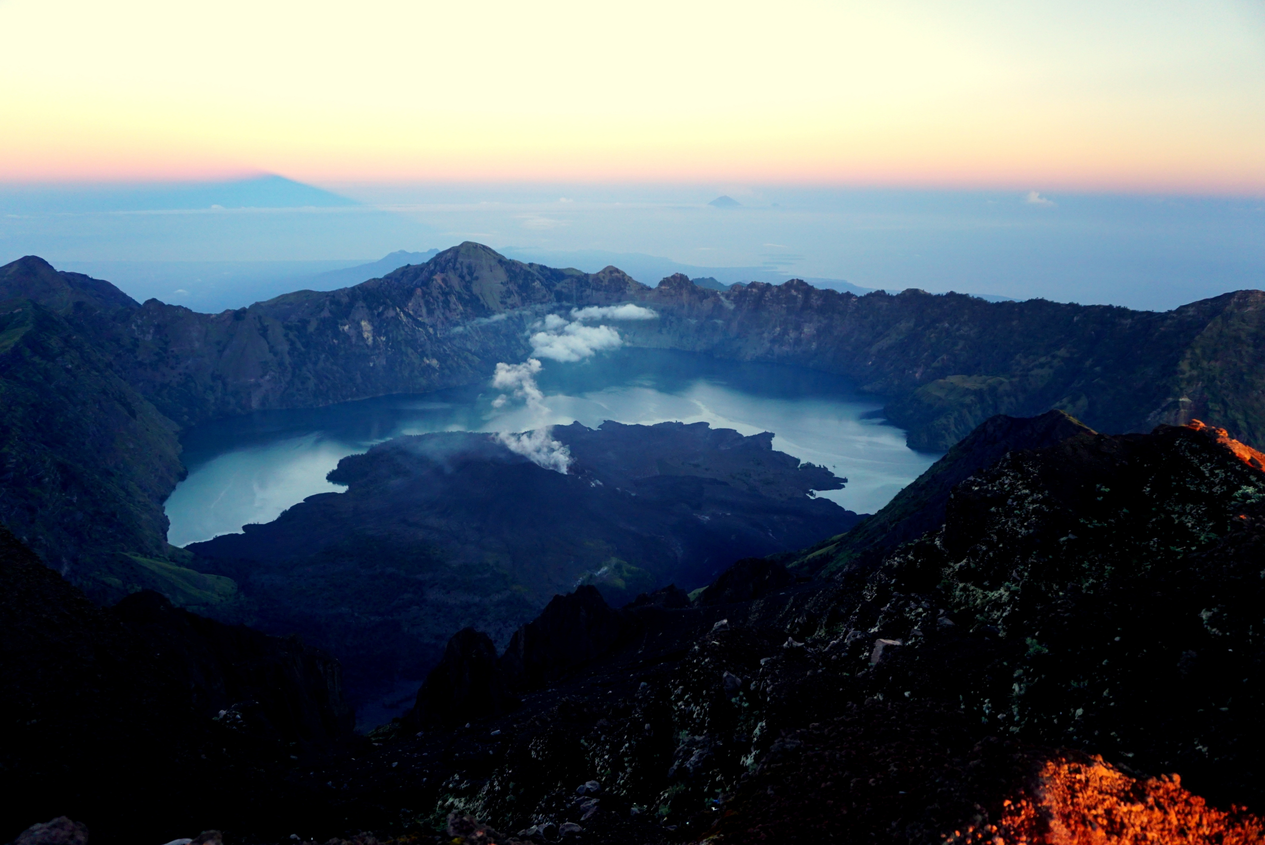
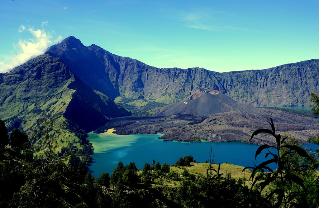
The moment that light first pierced through the skies, I was only three quarters my way up to the summit. I looked up at the peak to what seemed near but truthfully, impossible to reach within the time that I have left. It was unfortunate that I could not reach the summit as we had a time limit to hike down to our next campsite before the sun sets. Whatever disappointment I felt, it was compensated with relief and some level of accomplishment. As I looked around me, I could still watch the sun rising on my left as the crater lake on my right, Segara Anak slowly came into view. In that moment of awe, I sat down by the nearest rock and took some time to rest while I wait for the rest of my friends who managed to reach the peak (kudos to them!), to come down.
The descent began, from the summit, all the way down to our next campsite, the base of the crater lake, Segara Anak, which took another 3 painful hours. We finally made it to the site, to be greeted with lunch and views of the lake. I believe that super humans truly exist after meeting our guide and porters! Many of them have been hiking this mountain for years, all carrying weights up to 40kgs, some walking bare footed, some just with thongs. They are the epitome of super humans!
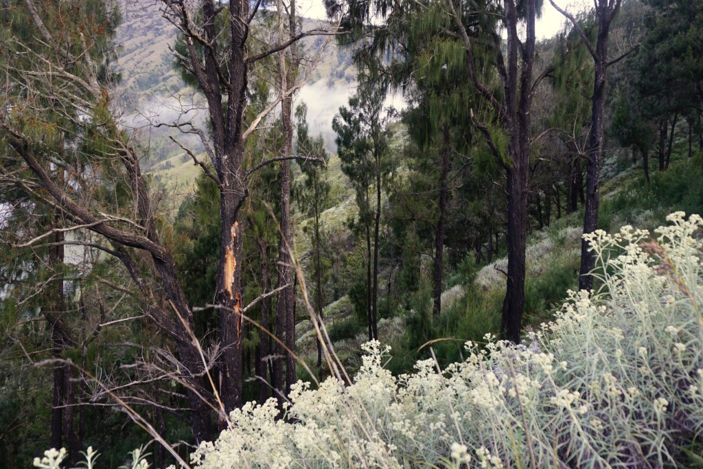
Day 3 – The hike into the forest
After the extremely challenging hike to the summit, we were all looking forward to a more relaxed “walk in the park” kind of hike for the next two days. But life isn’t always going to go your way. Soon enough, we were pulling ourselves up, through the forest and gasping for air.
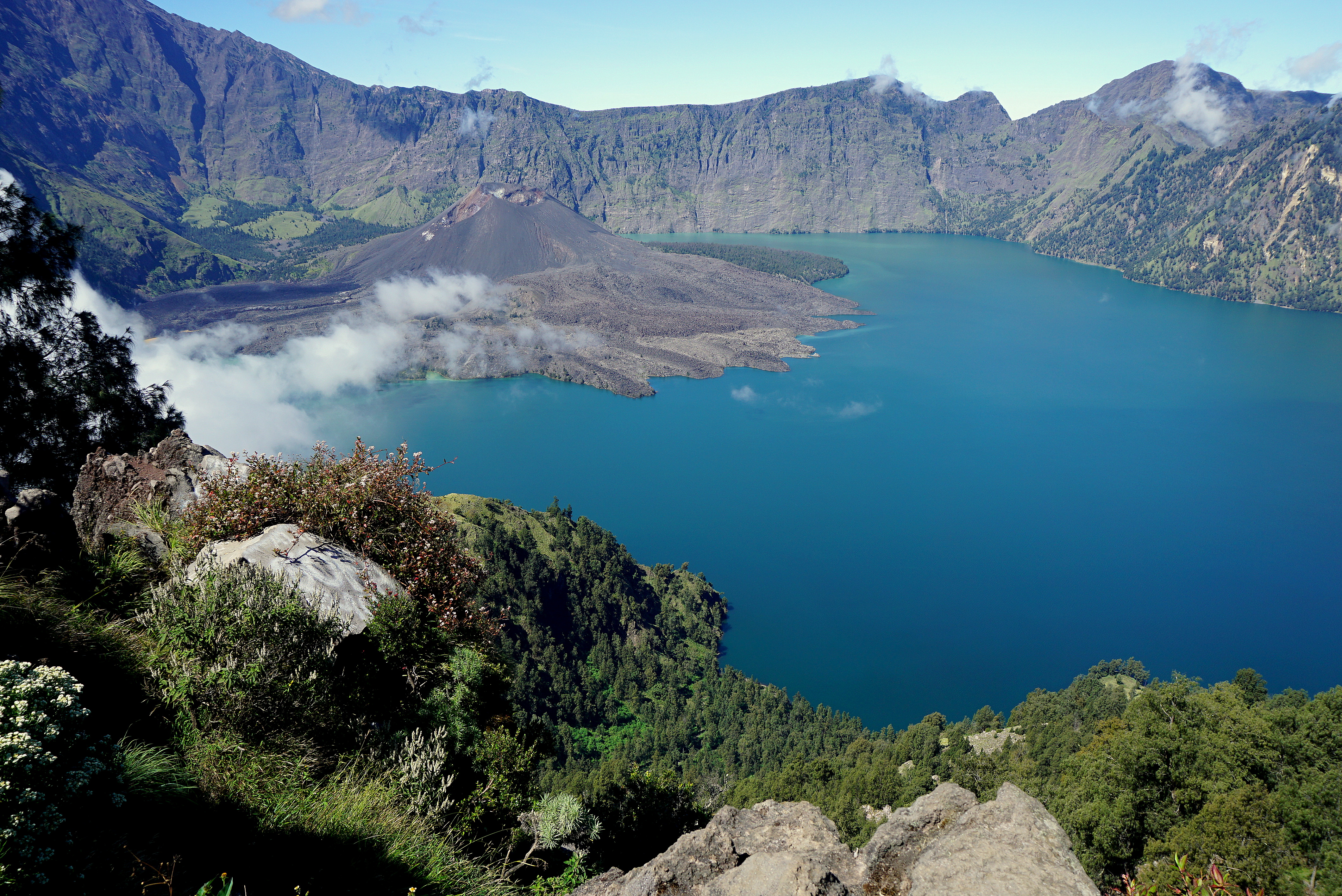
On the bright side, what I loved about this hike route was that it was along the crater lake. We were constantly blessed with beautiful views of the lake, echoing a deep turquoise colour, surrounding the active mini volcano (Mount Barujari). That totally made up for the unexpected hike difficulty on the third day.
Later in the day we moved down to an intimidating path of rocks. It was combined with sandy paths which was quite dangerous if not careful! There were countless times where I almost slipped, but managed to pull myself together, mostly thanks to my walking pole. As we descended further, we went through the forest. It also started to rain, creating a slippery pathway downwards. Again, my walking pole was keeping me steady the entire time as I brisked through downward. I swear, this walking pole is the ultimate SHIZNIT of my entire trip.
That night, we sat around the campfire, pondering on our last night here and reminiscing about the day before; just about how we were struggling, pulling every fiber in our body up to the summit! All smiles and laughter now that the torture going up the hill was over. The warmth from the campfire definitely lit our hearts a little.
Day 4 – The last leg
On our last day, we continued through the forest, surrounded by trees that shadowed us from the sun. This was by far the easiest leg compared to the last 3 days. THIS was the “walk in the park” that I was expecting. We were smiling throughout, talked and sang our hearts out, downward the mountain.
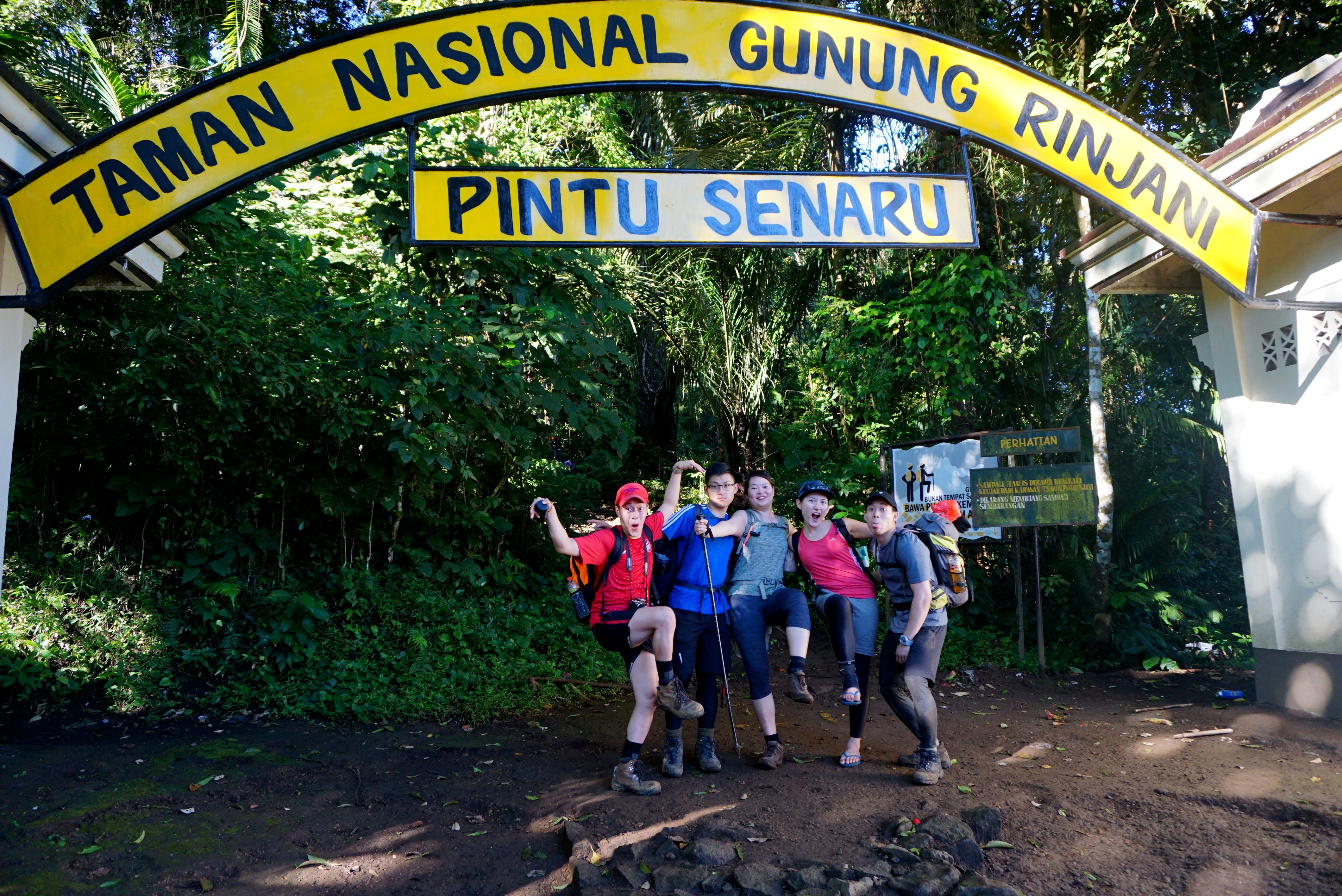
In no time, we reached the entrance of Senaru, the end of our route. We saw the yellow sign and our hearts screamed! Finally! A glimpse of civilisation after days in the Rinjani National Park. Our legs were giving up but we ran towards the gate like our lives depend on it. We gathered whatever energy we have left to strike an uncanny pose.
Summary
Rinjani was by far the toughest hike I’ve done. It covered all kinds of terrains; sandy, rocky, slippery forest, mud. It challenged my limits both physically and mentally. I remembered so many times that I felt like giving up, but still, I managed to pull myself through. At the end, there was so much sweat, muscle aches and burnout from the scorching heat.
I have gained so much respect for the Rinjani guides and porters. They do this crazy hike on a need basis as their main source of income. I am truly grateful to these men and their services.
You can say that this hike was EPIC, in so many levels.
Attempt it? Oh yea, you must.